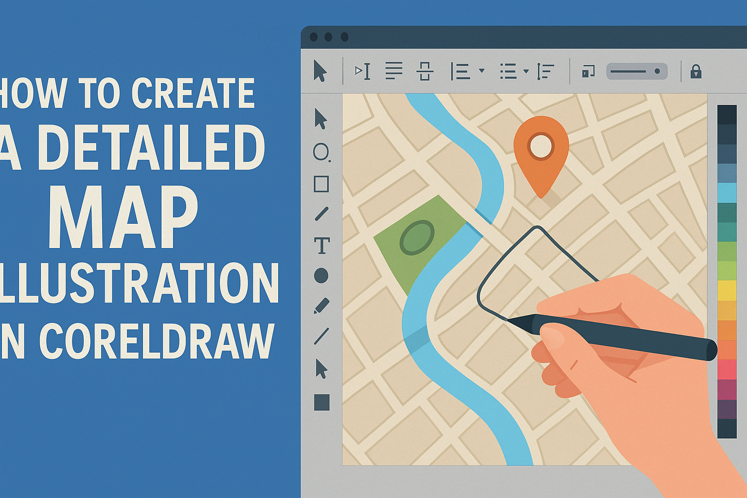
Creating a detailed map illustration in CorelDRAW can transform any project, whether it’s for educational purposes, corporate presentations, or personal art. CorelDRAW offers a range of tools that make it easier for artists and designers to bring their cartographic visions to life. With its intuitive interface and powerful features, CorelDRAW helps users craft intricate map illustrations from start to finish.
For those looking to learn how to make their maps compelling and visually appealing, exploring this software’s capabilities is a great start. By incorporating different design elements and perspectives, map illustrations can become not just informative but also captivating works of art.
From drawing major roads to highlighting landmarks, each step in CorelDRAW allows for creativity and precision. Readers will discover techniques that bring flat representations to life, offering both beauty and clarity to any map project.
Understanding CorelDRAW
CorelDRAW is a versatile graphic design software used worldwide. It helps both beginners and professionals create stunning designs, including detailed map illustrations. Its intuitive interface makes it easy to learn even for those new to graphic design.
Key Features of CorelDRAW:
- Vector Illustration: Create crisp and clean graphics.
- Page Layout: Design pages with detailed control.
- Photo Editing: Adjust and enhance images for your projects.
- Typography: Explore text options to match your design needs.
When creating detailed map illustrations, CorelDRAW offers numerous tools. The software’s vector capabilities allow precise editing and resizing without losing quality. Users can draw intricate details, which is essential for detailed maps.
CorelDRAW also provides an extensive library of learning resources. This includes tutorials, webinars, and step-by-step guides available on their official site. These resources support users in mastering the software’s various features.
One popular use of CorelDRAW is in creating isometric illustrations. This style is perfect for designing three-dimensional objects on two-dimensional media. Learn more about this technique and its applications through insights on isometric illustration.
Setting Up Your Workspace
Preparing your workspace in CorelDRAW is crucial for a smooth map illustration process. Focusing on navigating the interface, customizing toolbars, and creating a new document can help users work more efficiently and creatively.
Navigating the Interface
Users must familiarize themselves with the CorelDRAW interface to make the most of their tools. The top bar has access to menus like File, Edit, and View, while side toolbars provide quick access to commonly used tools.
The dockers can be customized for easy access to essential features like Object Manager and Color Palette. Users can open any tool or feature by clicking on it, which will make their tasks faster and easier. Understanding these elements aids in a more productive workspace setup.
Customizing Toolbars
Customizing toolbars allows users to streamline their workflow. In CorelDRAW, users can add or remove tools by right-clicking on the toolbar and selecting “Customize.” This menu lets users drag and drop different tools according to their preference.
Essential tools for map illustration like drawing, coloring, and text tools can be placed together. This setup makes accessing frequently used features quicker and simplifies complex tasks. Adjusting tool visibility ensures that users are not overwhelmed by unnecessary options, keeping the workspace clean and focused.
Creating a New Document
Creating a new document correctly is key for any project. Begin by opening CorelDRAW and selecting File > New from the menu. Users should choose the correct page size and orientation based on the requirements of their map.
CorelDRAW allows setting custom measurements like pixels or millimeters and adjusting color modes. Designating transparency settings and selecting the appropriate raster or vector option ensures that the map illustration is of high quality. These initial settings are vital so the document fits the project’s needs, leading to a successful map creation process.
Drawing Basic Shapes
Learning to draw basic shapes is a vital part of creating detailed map illustrations in CorelDRAW. The tools available allow users to form and modify shapes easily, making the design process more intuitive and efficient.
Using the Shape Tool
The Shape Tool in CorelDRAW is essential for adjusting vector shapes. With this tool, users can easily modify shapes by manipulating nodes and control points. When a shape is selected, the tool allows them to drag nodes to reshape lines and curves.
By using keyboard shortcuts, they can combine shapes or break them apart. For instance, holding down the “Ctrl” key while dragging can constrain movement to specific angles. This enables precise adjustments, making the shapes fit the design requirements.
Understanding how to use the Shape Tool helps streamline the creative process, allowing for smoother transitions and better accuracy. By mastering these functions, users can evolve simple shapes into complex illustrations effortlessly.
Manipulating Lines and Curves
Manipulating lines and curves is crucial for achieving the desired map detail. CorelDRAW provides multiple tools to refine these elements. The Bezier Tool is particularly useful for creating complex curves through control points. By clicking to place these points, users can stretch and adjust the curve.
For smoother edges, the Smooth Tool can reduce jaggedness by averaging out the curve. This ensures a cleaner look, especially important for professional maps.
Tricks like holding the “Shift” key while dragging for symmetrical curves can significantly enhance design precision. Mastering these techniques allows for greater control over the map’s design elements.
Utilizing the Rectangle and Ellipse Tools
The Rectangle and Ellipse Tools in CorelDRAW are quick ways to add basic shapes. By clicking and dragging the mouse, users can create rectangles and ellipses of any size. For squares or perfect circles, holding down the “Ctrl” key maintains equal proportions.
These tools also feature options to round corners or adjust dimensions, which is handy for various map components like buildings or landmarks. With more complex designs, these shapes can serve as bases before more detailed modifications.
Experimenting with these tools can lead to unique design elements, enhancing overall creativity. Being aware of these functionalities is beneficial for both beginners and seasoned designers looking to create detailed maps.
Designing the Map Layout
Creating a detailed map illustration involves organizing layers, setting up guidelines, and choosing the right color palette. Each step plays a crucial role in ensuring the clarity and visual appeal of the map.
Organizing Layers
Layers help manage different elements of the map, making it easier to edit and enhance. Begin by creating separate layers for roads, buildings, and landmarks. This makes it simple to adjust specific details without affecting other parts of the illustration.
In CorelDRAW, the layer manager allows artists to lock, hide, or rearrange layers easily. Using naming conventions like “Roads” or “Rivers” keeps the project organized. Group related items together to streamline workflow, especially in complex map designs. This structured approach improves efficiency and reduces the chance of errors.
Setting Up Guidelines
Guidelines are essential for aligning elements accurately. They ensure that streets run parallel, buildings are positioned correctly, and all features align with the map’s orientation.
Establish vertical and horizontal guides first, followed by any diagonal ones needed for specific map features.
In CorelDRAW, guidelines are created by dragging from the rulers on the edge of the canvas. They can be customized for precise measurements, which is crucial for maintaining scale and proportion. Consistent use of guidelines results in a more professional and precise map layout.
Choosing a Color Palette
A well-chosen color palette enhances readability and aesthetics. Start by selecting colors that differentiate between land, water, and features such as parks or urban areas. This can be achieved using contrasting hues and shades.
CorelDRAW’s color management tools allow for easy experimentation with palettes. Consider the mood and purpose of the map—bright colors for playful themes or muted tones for serious or historic maps. Consistent use of color ensures that the map is visually cohesive and easy to interpret.
Adding Geographic Elements
Creating a map illustration in CorelDRAW involves adding various geographic elements that bring the landscape to life. These components include landmasses, bodies of water, and natural features like mountains and trees.
Drawing Landmasses
To start, landmasses form the foundational base of any map. Begin by outlining the shapes of continents, islands, or specific areas using simple shapes. In CorelDRAW, use the Bezier tool for precision. Adjust the curves to match the contours of the actual landmass for accuracy.
Next, consider adding details such as coastlines and borders. This can be done by enhancing lines with different styles or widths. These small details make the map more realistic and informative.
Applying colors enhances these outlines. Earth tones like greens and browns work best to represent land. Use gradients to create a sense of depth.
Creating Water Bodies
Water bodies such as oceans, rivers, and lakes add a dynamic element to a map. In CorelDRAW, draw these using the Pen tool or Freehand tool. Ensure the lines are smooth and continuous.
Choose blues and greens for coloring water. For added realism, consider lighter tones for shallow areas and darker shades for depth. Apply gradients to mimic natural water reflections.
Use patterns or texture fills to represent waves or currents. This hints at movement, giving the map life. Label prominent water features clearly to assist users in identifying them.
Designing Mountains and Trees
Mountains and trees add natural beauty and provide important geographic information. Start by sketching basic shapes for mountains. Use triangles for peaks, then refine them with the Shape tool. Experiment with shading to create a 3D effect.
For trees, use simple symbols. You can create custom symbols using the Artistic Media tool. Adjust settings to suit different types of trees, from broadleaf to coniferous.
Adding textures or shadows enhances these features. Make sure they complement the surrounding landscape. Placing these elements accurately reflects real-world geography and enhances the map’s usability.
Incorporating Roads and Structures
When creating a detailed map illustration in CorelDRAW, incorporating roads and structures is crucial for making the map understandable and realistic. This involves tracing road pathways, illustrating buildings, and marking points of interest. Each element must be drawn with care and attention to detail.
Tracing Road Pathways
To trace road pathways, start by importing your reference image into CorelDRAW. Use the Bezier tool to draw smooth, accurate lines that follow the path of roads.
Ensure each road type—such as highways, streets, and alleys—has a distinct line style or color. This helps users differentiate between them.
Consider adding road markers like lane dividers or crossings. These minor details can significantly enhance the map’s realism and utility. Keep the lines smooth and proportionate to maintain a clean look.
Illustrating Buildings
Illustrating buildings begins with sketching the basic shapes. Use the Rectangle tool for most structures, but don’t hesitate to employ other shapes like ovals or polygons for more unusual structures.
For details, consider adding windows, doors, and rooftops. Layering different elements adds depth and character.
Using a consistent architectural style and color palette can unify the design. This clarity helps users identify different building types, such as residential or commercial areas.
Marking Points of Interest
To mark points of interest, first, identify key locations like parks, landmarks, or schools that are significant to the area’s purpose. Use icons or symbols to denote each point of interest.
Ensure they are simple yet recognizable. You might choose to add a small label next to each icon for clarity.
Use colors that stand out but do not clash with other map elements. Consistency in icon size and style helps maintain a polished look. This aids map readers in locating important sites quickly.
Enhancing the Map with Textures and Patterns
Adding textures and patterns can bring your map illustration to life in CorelDRAW. These elements create depth, variety, and interest, offering a more engaging view. Below are methods of applying textures, creating custom patterns, and using blends for detailed effects.
Applying Textures
Textures can give a sense of realism by mimicking natural surfaces such as mountains or forests. In CorelDRAW, users can explore a variety of texture fills which can be applied to different areas of the map.
Select an area of the map you want to enhance and choose the Texture Fill tool. Adjust parameters like density or pattern rotation for a tailored look. Realistic textures can help viewers understand the geographical features represented.
Consider using vector textures for scalability, ensuring that the map stays crisp at any zoom level. Applying textures thoughtfully will make the map visually appealing and informative.
Creating Custom Patterns
Custom patterns allow for a unique and consistent style across the map. Using CorelDRAW’s tools, creating patterns is straightforward and offers endless customization.
First, design a small pattern tile that seamlessly repeats, using shapes and colors that fit the map’s theme. Convert it into a pattern fill by grouping the elements and using the Define Pattern option.
Regularly check for seamless repetition by applying the pattern to larger areas. This process ensures a cohesive look without distracting seams or breaks. Custom patterns can reflect features like road types or population densities, making them both attractive and useful.
Using Blends for Detailed Effects
Blends can create smooth transitions between colors or shapes, adding depth to map illustrations. CorelDRAW’s Blend tool is powerful for achieving these effects.
To begin, select two objects or colors you want to blend. Use the Blend tool to create a series of intermediates that transition from one to the other. Adjust the number of steps in the blend for a finer or more pronounced effect.
Blends are excellent for showing elevation changes or water depth, offering a more dynamic visual. Ensure blends enhance clarity by maintaining enough contrast between elements for easy recognition.
Inserting Labels and Legends
When creating a detailed map illustration in CorelDRAW, labels and legends play a crucial role. They help users understand the map’s features, symbolize elements, and provide clear navigation. In this section, find guidance on adding and designing text labels and creating a meaningful legend with appropriate symbols.
Adding Text Labels
Text labels identify important landmarks, roads, or areas on a map. To start, use CorelDRAW’s Text Tool. Click on the map location where the label will go, and type the name or description.
Fonts should be legible and complement the map’s style. Opt for simple and clean fonts like Arial or Verdana. Adjust the size according to the prominence of the labeled feature.
Positioning is key for readability. Align text horizontally or vertically, ensuring no overlap with other map elements. Consider adding background color or a shadow effect for contrast against busy backgrounds. Reviewing for spelling accuracy is vital, as errors can confuse users.
Designing the Legend
A map legend explains symbols and colors used. In CorelDRAW, begin by creating a small box or frame at the map’s edge or a corner. This is where each symbol and its explanation will appear.
The legend should include all symbols and colors used on the map. For each symbol, provide a simple and concise description. Use bullet points or columns for organization, ensuring clarity.
Grouping similar items together makes navigation easier. For example, place all transportation symbols together. Adjust the size of symbols in the legend to match their prominence on the map, while maintaining consistency across different elements.
Incorporating Symbols
Symbols convey information quickly and should be simple yet distinctive. CorelDRAW’s tools allow for custom symbol creation or the modification of default options. Start by choosing symbols that directly represent map features, such as boats for harbors or trees for forests.
Color is important for differentiation, using distinct hues for different categories. Keep the color palette consistent with the legend for user understanding. Placing symbols evenly across the map avoids clutter, ensuring they don’t obscure important map details.
Dragging and dropping symbols in CorelDRAW makes placement straightforward. Adjusting symbol size can reflect the importance or size of the feature it represents, aiding in visual hierarchy. Periodic review of symbol placement guarantees clarity throughout the map.
Finalizing Illustration Elements
When creating a detailed map illustration in CorelDRAW, the last steps involve refining the illustration. It is important to fine-tune the colors, add finishing effects, and ensure that the overall composition looks balanced. These steps help in making the map visually appealing and effective.
Adjusting Final Colors
Choosing the right colors for a map illustration is crucial. In CorelDRAW, artists can use the color palette to adjust hues and saturation. This might involve tweaking the brightness or selecting a different shade to ensure clarity.
They should also pay attention to contrast. It’s vital for readability, making sure text and symbols stand out against the background. For thematic maps, using monochromatic color schemes can unify the visual style.
With resources like the Complete Guide to Illustration by CorelDRAW, artists can explore various techniques in color adjustment. These changes should align with the map’s theme and purpose, leading to a cohesive final product.
Applying Finishing Effects
Once the colors are set, applying finishing effects can add depth and interest to the map. Using CorelDRAW, tools like shadows, transparencies, and gradients can make elements pop. These effects should be applied thoughtfully to emphasize important areas.
Textures can be introduced to give a tactile feel. For instance, a paper texture might give a vintage look, while lineless art styles can provide a clean, modern appearance.
It’s important to ensure that effects do not overwhelm the core elements of the map. Moderation is key, as too many effects might distract from the main message or reduce readability.
Checking Overall Composition
Finally, artists should step back and review the whole composition. They should ensure balance in the arrangement of elements, with careful consideration of spacing and alignment. This might involve minor adjustments to positioning or scaling.
It’s beneficial to seek feedback from peers to identify any overlooked details. Elements should guide the viewer’s eye naturally across the map, highlighting key areas effectively.
Checking the illustrated map guide can provide tips on composition balance, helping to create a harmonious map.
Exporting Your Map
When exporting your detailed map illustration in CorelDRAW, it is crucial to choose the right file format and optimize your map for its intended use. Each step can ensure that your map maintains its quality and accuracy, whether for print or digital use.
Choosing the Correct File Format
Selecting the right file format affects the quality and usability of your map. For instance, if your map will be printed, formats like PDF or TIFF are ideal because they preserve details and support high resolutions.
For digital use, consider exporting as a PNG or JPEG. JPEG is great for smaller file sizes, which helps with faster loading times online. PNG retains more detail and allows for transparent backgrounds, making it useful for layering images on websites.
Understanding the purpose and destination of your map will guide your choice in file format. It’s essential to check the specifications required by your printer or online platform.
Optimizing for Print or Web
Optimization involves adjusting settings to ensure your map looks its best in its final form. For print maps, set a resolution of at least 300 DPI. This ensures that the details remain sharp and clear once printed.
For web-based maps, a resolution of 72 DPI usually suffices. This reduces the file size, which is critical for faster loading times, especially for users with limited bandwidth. Also, use RGB color mode for digital maps and CMYK for printed ones.
CorelDRAW offers tools to help with these adjustments. It’s important to review the final outputs to catch any visual discrepancies early on.
Proofing and Prepress Checks
Proofing involves reviewing your map for errors before finalizing it. Check for any spelling mistakes, color mismatches, and alignment issues. Print a test copy if possible, to see how it looks physically.
Prepress checks are vital, especially for commercial printing. Ensure that all used fonts are embedded, and verify that any linked images are high resolution and not prone to pixilation. Calibrate colors using the printer’s profile to match expectations accurately.